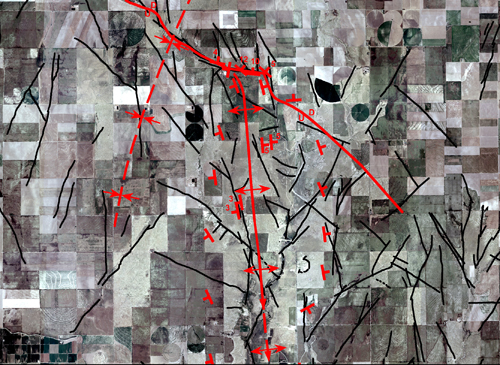
Geologic interpretation of surface
structure from airborne or satellite data focuses on mapping folds,
faults, and major fracture zones as manifested in the surficial rocks.
Satellite data provide a synoptic view of large areas which permits
the detection of large structural features and regional relationships
that have escaped previous recognition. Stereo air photos provide high
resolution, 3-D views enabling detailed structural analysis. The approach
relies heavily upon standard photo interpretation techniques plus a
solid foundation in structural geology and tectonics. Mapped surface
and subsurface faults and structures are digitized and are included
in the interpretation as a GIS layer. The strike and dip of beds and
the direction of throw on the faults are mapped where discernable. Existing
maps serve as reference during the interpretation and are modified as
necessary. The synoptic view of the satellite or airborne images allows
us to cover large areas at scales up to 1:24,000 in a very short time.