|
|
 |
|
|
|
Quantitative Structural Mapping |
||
|
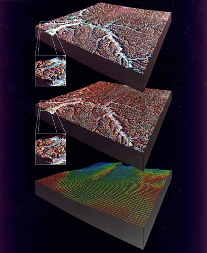
This approach involves digitally combining elevation data with satellite images to produce a three-dimensional model of the surface. In many areas, this model allows one to accurately infer the structural configuration of the near surface rocks. Using satellite data, one can interrelate spatially separated features, detect subtle changes in tone and texture that may mark large subsurface features, and identify regional scale structures, all of which forces a new perspective for geologic consideration. In every instance where we have employed this approach, we have identified new exploration plays and opportunities. Combining digital elevation models and careful geologic mapping on digital imagery creates a highly refined structural model. This model identifies subtle structural traps that have been overlooked.
|
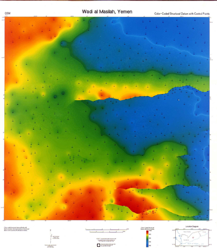
Color Coded Structural Datum with Control Points |
|
|
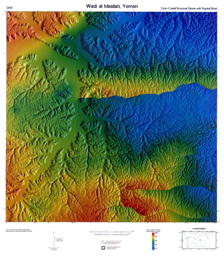
Color Coded Structural Datum with Shaded Relief |
||